Cascadia Maps
David McCloskey’s bioregional maps of Cascadia and the Ish River country
are beautiful and “stunningly detailed.”
The second edition of the Cascadia Map, Cascadia 2 Map is now available.
Cascadia 2 Map
Size: 27 ⅝” w X 39 ¼” h paper edge to edge
The second edition of the path-breaking Cascadia Map by David McCloskey is now available!
The original award-winning bioregional Map-Atlas created in 2015 has been updated, revised, and enhanced….
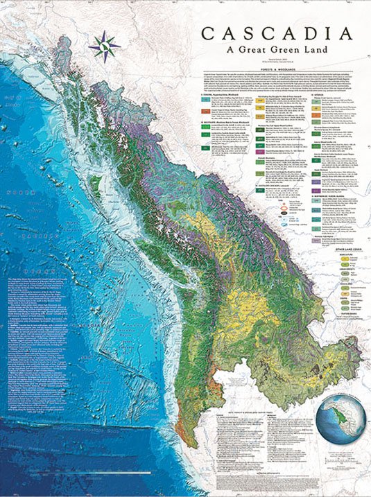
This handsome map shows “A Great Green Land” stretching from the Pacific coast to the crest of the Continental Divide, and from California north to Alaska. It shows how the land works on many levels. It explores the natural and cultural integrities of this place, making it a coherent and whole bioregion. In linking land and sea together, it shows the North Pacific seafloor and Cascadia Subduction Zone in dramatic relief. The map also provides an integrative cross-border framework to understand regional vegetation and shared ecosystems. It also shows Cascadia in the wider context of the macro-Bioregions of Western North America.
What’s new:
• 2X the resolution of Land & Sea—showing terrain and seafloor in tactile 3-D immersive relief, revealing the entire region in stunning detail.
• Enhanced Icefield & Glacier coverage in an era of rapid climate change showing 64 of the 100 largest Icefield clusters, 60% newly named here; (Cascadia has 5 of the 12 largest non-polar Icefields in the world!).
• Key geologic features—e.g. the Cascadia Subduction Zone (Trench), the Yakutat Block, fault lines such as the Queen Charlotte & Transition Faults, etc. generating the fastest rising uplift in the world in the St Elias-Icefield Ranges, culminating in the great massif of Mt Logan, the second highest mountain in North America, where everything tends toward, revealing Cascadia as the crown of North America.
• A “Fire & Ice” section:
--introducing a new volcano symbol showing many volcanic centers in the region;
--showing the max extent of the edge of the great Cordilleran Icesheet from the northern tier of states all along the N Pacific Coast to Alaska.
• A major revision of the Legend to show “Topoclimates” in terms of Location, Elevation, Sides (Windward/Leeward), by main Precipitation & Temperature modes thru both Winter & Summer for each Forest Formation … providing the most advanced Legend in cartography showing the fabric of Cascadian Flora flowing across the grain of the land for the first time.
• Revision of Color Palettes for both VEG and Seafloor bathymetry to call out key features….
Casc2 is the finest map of our region ever made!
Ish River - Salish Sea Map
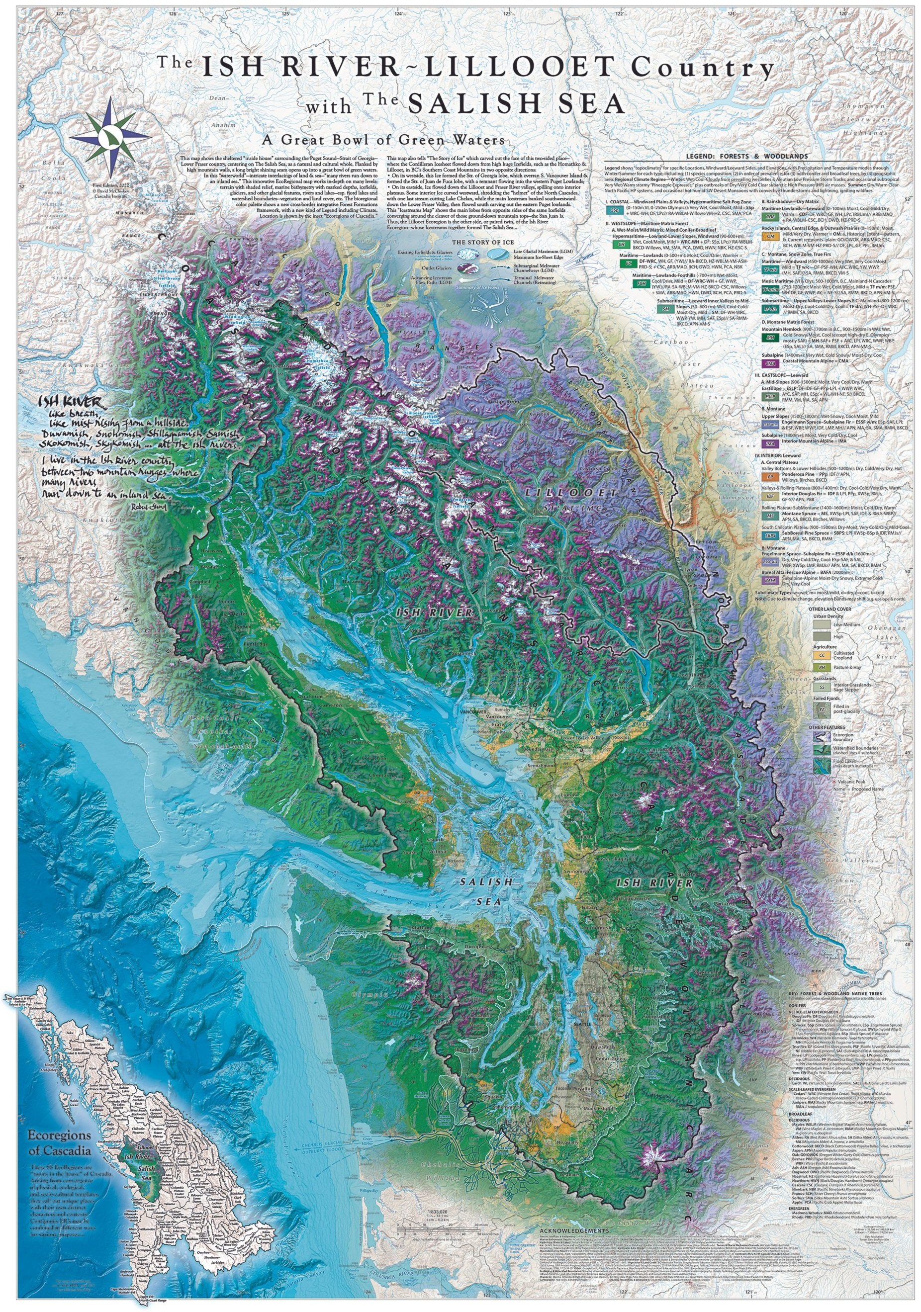
This beautiful new map, companion to the Cascadia Map, shows “The Great Bowl of Green Waters” of The Salish Sea from high Mountains’ crest down thru lush river valleys running into the saltsea... Stunningly detailed, it shows the life of this land on many levels, and tells graphically for the first time the "Story of Ice" in shaping this place...
Original Cascadia Maps - Black & White

Description in process.
2015 Cascadia Map
Cascadia MegaMap -- 15’ h X 11’ w !--@ Esri User Conference, July 2015, in San Diego, honoring the map’s selection as “Map of the Year” gracing the cover of their 30th Annual Map Book, showcasing the best maps created in the world in the last year! (Cody Camarata standing in front, photo by Alex Philp).


